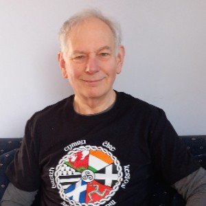
Six Celtic Summits for Prostate Cancer

By Duncan McMillan Join Me

I'm fundraising for a great cause!

I was diagnosed with an aggressive form of prostate cancer in 2018, and I’m looking forward to raising important funds for the research and work the Prostate Cancer Foundation does, including raising awareness and providing support  for the men, and families affected.
 
Prostate cancer is the second most commonly diagnosed cancer in New Zealand. Every year, in New Zealand, more than 4000 men are diagnosed with the disease and over 700 die – the second highest cause of cancer death in men after lung cancer. For all sexes it sits third behind lung and bowel cancers.
 
My goal is to get to the highest points in each of the Celtic Nations (Brittany, France; Cornwall, England; Ireland; Isle of Man; Scotland; and Wales) with the flag of the NZ Celtic Summer School and the relevant flag of the locality, starting in Cornwall in mid-August with Bronn Wennili (Brown Willy , 420m) and ending in the first week in September hiking  to Roc’h Ruz and Roc’h Trédudon (385m) in Brittany. To get to and between the points I will be taking planes, trains, trams, a ferry, hiring a car, and hiking.
 
As well as raising funds for NZ Prostate Cancer Foundation, attempting to meet the goal is also a part of my personal, physical and mental journey with the disease, and my way of honouring the many men and families affected by it.
 
Please spread the word, support the foundation, and donate.

#ProstateCancerNZ   #earlydetectionsaveslives   #GetChecked

My Updates

Final Words

Friday 5th Sep

Many thanks for supporting me and the New Zealand Prostate Cancer Foundation in my Celtic Challenge.

It was hard work and a mixture of exciting and anxious, and at times very challenging - made easier by the people who supported me and those I met on the way who encouraged me - but always worthwhile for a great cause and to honour those affected by prostate cancer.

Roc’h Ruz and Roc’h Trédudon

Friday 5th Sep

Well, the final day of the challenge had come. After breakfast, I walked to the railway station where all the agencies had a stand. Well, not all. My agency wasn’t there. Time was getting closer to the time I was supposed to pick up the car. Eventually, I found out that my agency was about 300m away on the same road that lead to the station.  I arrived at the agency and managed to use my French to understand what they were asking and was able to reply and get the car.

I set up the cell phone holder, got the route and we were off. It was difficult getting used to cars on roundabouts coming from the left and having to look to the right for the mirror in the car, but it gradually became easier.

Driving on the motorway out of Brest I realised that the nearest diesel on the way back would be on the wrong side of the motorway and I could see no other one on the map close by.

Things were going really well until I reached my first road closed sign on the route Google was taking me. Google directed me down a different road to the one marked as the deviation, so I was beginning to wonder. On my route to the destination I met two other road closures not on the Google map. I was running 30 minutes later than expected.

I had tried to get a detailed physical map of the area without success. However, I did have a reasonable map for the walk and related car parks in the area from my book on the Armorican Geopark, so I managed to find a parking area near the cemetery. Was this an ominous sign?

By now the weather was flipping between sun, and heavy rain and wind but I was on my way. Twenty minutes or so later I came to a junction and there was no expected marker for the trail. I must have missed something somewhere in the rain.   I kept going, worked out where I was and spotted the telecommunications aerial near the highest points. Following the track, I worked out how to get back onto the round the summits track and get to Roc’h Ruz and Roc’h Trédudon.

I took a narrow track off the main track through gorse and came to the rock outcrop and scrambled up. It was sunny. So, I took off my rain coat for the picture with my special t-shirt. However, by the time I had set up the flag pole and the flags the rain had returned, and it was quite windy. I managed to grab a few pictures using the selfie stick and then got ready to scramble down and go for the next summit – Trédudon.

This narrow track off the main track was more challenging than the track to Roc’h Ruz and climbing up was more difficult holding the flagpole with flags. A brief period of sunshine, then the rain with wind. The prostate cancer banner part ripped off - I managed to grab it before it sailed away. I placed it in my mouth for the final picture and then it was done. I had finished the challenge.

The details of what happened next are a whole new story. In summary, I returned the car and had a celebratory dinner.

To Brest

Friday 5th Sep

One of the challenging aspects of St Malo is that it seemed difficult to go for the day to many of the interesting surrounding areas by public transport when I looked a few months before the trip. I therefore chose to spend time in Brest, as it seemed easier to get to those areas from there, and to a hire a car from Brest to get to the two highest places in Brittany.

The transport difficulty is also illustrated by the fact that to get to Brest from St Malo I had to travel to Rennes and then from Rennes to Brest. I had booked the regional train to Rennes and then later a TGV train to Brest to allow ample time getting between trains and to get some refreshment. Everything was going well, and I got up from where I was eating and drinking to go to the toilet taking all my things with me. The toilets are pay toilets at Rennes station so it involved a bit of juggling and with the luggage etc it was quite challenging. After there, I felt something wasn’t quite right but couldn’t work out what it was.

I had my ticket validated and when I got to the platform I realised that I was missing the bag with my Calvados in. Should I go back and try and find it and possibly have to buy a new ticket, or leave the bag behind. By this time the train was due. A few minutes later I heard my name being called out over the tannoy and the train hadn’t come. I found an official and I explained who I was. I had to go back off the platform to collect the bag. What an embarrassment – there was my bag with the Calvados in it in an open area of the station with a security cordon around it…  with my name tag on the bag. I had labelled all my bags when I sat down to eat at Rennes. I apologised profusely in French and showed my identity, was given the Calvados bag, and the security cordon was swiftly taken away.

However, by now the train had gone, so, I had to buy another ticket. The reasonably priced Calvados was now expensive Calvados!

I caught the next train to Brest, and found the tourist information office. They were very helpful in providing maps and explaining the area and working with my French/English. I then went to buy food and drink from a hypermarket before walking to my accommodation. Having unpacked, I timed my walk to the railway station as it was from there that I was going to pick up the rental car the next day, or so I thought, for the final stage of my challenge.

Returning to the accommodation I prepared for the next day, which was expected to have sunshine and showers and wind, and the final summits.

Visit to Mont St Michel

Friday 5th Sep

Second day in St Malo and I was to take a coach to Mont St Michel..

It was interesting travelling through the countryside and seeing the houses and fields and woods before we stopped in a massive car park. There was the option to take a bus from the car park to Mont St Michel but I opted to walk as it was only supposed to take 35 minutes and my entry to the Abbey started in 40 minutes.

When I turned the corner and saw Mont St Michel with the Abbey at the top, I was blown away – what an amazing sight. As you walk along you realise that many other people agree with that. The area on the walk has sympathetically been developed within the constraints of the marshes and river and the placement of the river barrage – everything seaward of the barrage could be flooded.

I was there at relatively low tide and you could see how the mount rising from the low surrounding area would be cut off most of the time if it wasn’t for the bridge. The external beauty of the Abbey and spire stood out.

Once across the bridge, there are the ramparts and then steep narrow lanes across the mount, some of which have restaurants and shops and other areas for tourists. I quickly went up the steep alley to the abbey and passed through security. The abbey has at times been a prison and it is interesting to see the various rooms in this light. Whilst I was there, mass was being held, and the chanting and singing was very soulful with the sisters of the abbey in full white.

As well as the abbey, I also visited the museum which was a collection of artefacts and then a suite of waxworks telling the story of the abbey in French and highlighting some of the gruesome and less gruesome aspects.

After exploring the ramparts, and eating my lunch, it was time to dash back to the coach and return to  St Malo.

St Malo

Friday 5th Sep

I had never been to St Malo before. It is a great entry point to Brittany. Another reason for visiting was that it was the place that my parents went to on their honeymoon, so they must have been impressed by it.

As my accommodation wasn’t available until later in the day, I decided to go to the tourist information centre (about 1km or so away) to understand where things were, to determine if my ideas for the next two days and the rest of my time in Brittany would work and whether it would be better to buy the one week Brittany regional trains travel card (up to 5 people could use it on the regional trains in Brittany, not the TGVs) or buy the train trips individually.

When I had previously looked on-line, the buses didn’t appear to be available at this time of the year. However, when we looked there were now buses available to most of the places – the timetables must only be published a month or so out from their use. I was also offered a brochure with names of places to hire bikes from, and I picked up several relevant brochures and maps.

I started exploring St Malo and went up onto the ramparts. By this time, it was raining. I found a nice restaurant with a great view but when I enquired, they didn’t know when there would be a table free. I decided to wait. I was told that I couldn’t wait in the sheltered area, so I waited in the rain. Fortunately, after about 20 minutes a table became available and I was invited in, thanked for waiting,  and given a menu. To celebrate I ordered some Breton cider and a gallette and later had a dessert. I dried out and thoroughly enjoyed the meal.

My accommodation was in the Intra-Muros and although small, and up three flights of stairs, had everything I needed apart from food. The host had provided suggestions on where to get food, so I had soon sorted that aspect.

Whilst unpacking my bags I realised that I had omitted another pair of shoes, so for the French leg of the trip I was constrained to wearing boots or crocs! However, if I had included another pair of shoes I would have had to cut back further on clothes and other items that I wanted to bring as the predicted weather was variable, and space was limited.

I had planned to hire a bike to ride to Dinan, explore and then return or go by bus on my first full day in St Malo. However, after taking into account the expected rain, I decided to explore St Malo and rest prior to the coach trip to Mont St Michel the next day.   

The Intra-Muros was the old part of St Malo that was mostly destroyed in 1944 in the Second World War. The question was then raised as to whether to keep in its current state as a memorial or rebuild it much as it was previously. The city decided to re-build to be as it was – keeping the buildings and walls that remained and rebuilding the others. It is a remarkable success, has a great feel about it and is a major tourist attraction with many high brand shops and other tourist shops available, as well as the marketplaces etc as they were before.

To France

Friday 5th Sep

I had removed several things from my luggage and added additional guide books and maps for Brittany that I thought I might need. I was aiming to limit my luggage I took to France to my carryon bag, my laptop bag and my daysack.

I got a lift to the station from my brother and was early for my train. This was good as the only way to the platform from our direction was across the level crossing which was often shut for extended periods with no other way of crossing the line to get to the platform. Hence, if you left it too late you missed your train because the barriers were down for goods and passenger trains coming in the other direction.

Rather than go directly to Portsmouth to take the overnight ferry to St Malo, I was meeting up with the communications manager of the British Exploring Society – a charity that works with partners to open up opportunities to discover remote and challenging parts of the world and with a vision “for all young people to be able to contribute confidently in the world. We want equal access to challenging learning and adventure in the wilderness as an unbeatable preparation for adult life.”

I had previously been on an expedition with them working on a geology project prior to university. The society had been founded in 1932 by Surgeon Commander George Murray Levick RN, who had been a member of Captain Scott's final Antarctic Expedition of 1910-13.

I took the train to Paddington, underground to South Kensington and then walked to the Royal Geographical Society which includes the offices of the society. After a chat over coffee discussing the charity and a photo, I left for the Chelsea Arts Club where I was to meet a friend I had not seen for over 20 years. I had never been there before - it was a very interesting and relaxing place to meet.

Soon it was time to go, and after a walk to South Kensington tube station, and train from Waterloo, I was in Portsmouth. I had something to eat there and then walked to the ferry.

The setup seemed be designed for taking cars and lorries and there were very few foot passengers – we all fitted into one single level bus, after going through security. The bus then drove us into the hold of the ship and we clambered up the internal stairs to the reception.  

I had decided to book a cabin as the cost was less than a night’s accommodation and travel on other routes. The internal cabin was great. I had a good night’s sleep and was awakened 1.5 hours before the ship docked. The ship had many amenities and against my better judgement I bought a bottle of Calvados at a reasonable price from the duty free – it being an additional weight/article to carry along with my other luggage.

I also managed to speak to the leader of a cycling group travelling on the ferry who confirmed that it would be possible to get to Dinan and back to St Malo within a day.

2 and 3 days after Carrauntoohil

Friday 5th Sep

I had a lot of re-packing to do, as always when flying after hiking. This was to ensure that everything required for the next hike was in carryon including the daysack but excluding anything banned from the cabin e.g. penknife.  Batteries etc also had to be in the carryon.

I also took time to sort out a few things and be ready for the trip to my friends in County Kilkenny.

It was an interesting drive, mostly on rural roads, sometimes very narrow and occasionally with large lorries coming fast at you around bends as well as the usual farm vehicles. 

Finally, I reached my destination, had a great time there and next morning it was time to leave. It was a shame to leave Ireland as there was much more to do and see, but I had to move on to my last summit, in France.

The roads back to Dublin Airport were much easier than those to Thomastown, Kilkenny and the only hiccup was that I trusted Google rather than the signs for rental cars when approaching the airport. I found myself outside the terminal rather than the place for returns, found a petrol station and then found my way back to the rental returns after going around twice. Time was ticking for check-in but a very smooth rental return and a fast check-in, and no hold-ups in security meant that I was soon recovering in the lounge I could enter through my credit card agreement.

Soon I was onboard heading for Heathrow. After landing and collecting my luggage I was soon travelling back by coach and then train and lift to my brother’s place – the base for my time in Europe. I then had a day to rest, repack for France, and sort things out for the rest of my time in the Northern Hemisphere.

The day after Carrauntoohil

Friday 5th Sep

In the morning, I had confirmation that I could stay with the friends on the way back to Dublin and mentioned it to my host. Under the booking rules, I still paid for the extra night but I could have an afternoon start which would help with my tiredness.

When last in Ireland I had wanted to go and see the cliffs of Moher but didn’t make it. This time I was advised that it would be better to go to the Dingle peninsula, and in future also consider some hiking at Brandon.

So, off I drove to Dingle aiming for the Celtic and Prehistoric museum, although there was some doubt that it would be open. I took the scenic route to Killarney which was amazing, if full of slow-moving traffic. From there to the Dingle peninsula the roads were narrow and winding and surprisingly relaxing to drive.

When I got to the area, the only thing I could see was a prehistoric mound and an animal petting area with a car park, so I went to investigate. I realised that the ‘museum’ was back down the hill, so, as it was a great day for walking, I walked down to where the ‘museum’ would be. It was now a café.

The story was that an American had brought his collection there and opened it as a museum but that he had died a few years ago. The collection had very little relating to the immediate area and had been sold. So, I bought a coffee and a cake and opened my sandwiches and whilst eating reflected on whether his collection would have been meaningful to visit given the importance of the other things in the area of Celtic and prehistoric significance.

I went back to my car and drove around the peninsula, occasionally stopping to admire the views. 

It was to be my last night in the area, so I went to the local pub in Kilgarvan and had a good chat and a drink.

Carrauntoohil - the Highest Place in Ireland

Friday 5th Sep

After breakfast, I made sure all my gear and food were packed in the daysack, had my boots with me and set off.

Arriving at the meeting point, I walked into the shop and courtyard and could see lots of other groups but not mine. Eventually, after talking to a group leader, I checked my emails and realised that I had been mistaken, and the meeting time was at 9:45 not 9!  Oh, to have had an extra 45 minutes resting. However, it did allow me time to get ready and visit the shop and café.  I bought a great protein bar and decided to buy a souvenir and fruit cake when I returned from the summit.

I met up with the guide at 9:45 and then the rest of the group – a great bunch of people. Unfortunately, a few less than originally expected – part of the group had been involved in a car crash on the way to Kerry the day before and at least one of them had had to go to hospital to be checked.  

The ascent was the most technically challenging of the hikes to date with some scrambling and manoeuvring around rock faces. I was also slower because of the amazing views and photo opportunities. I had decided to use walking poles but at times they were more of a hindrance and slowed me down, so eventually I put them in my daysack for some of the scrambling sections.

Reaching the top, we were greeted by many other people who had taken a different route up that seemed more straight-forward. There was a queue for the top which gave me time to set up the flagpole and flags. Others very kindly took photos of us all and of myself with the flags. 

The views were amazing on this sunny day, even if it was chillier at the top with a wind.

Going down was much easier than our hike up and we met up with many other groups on the descent. Arriving back down, I bought a tea, a piece of cake and a special sports towel to commemorate the occasion and spent some time chatting with the group guide. I also chatted with another guide who had been guiding groups in mountains around the world for many years, despite not being that well. His story was quite inspirational.

On the way back to the accommodation, I stopped off at Killarney to get food for the breakfasts, lunches and dinners for the following days, and started planning for the next 2 days in Ireland. I was also wondering whether I should leave the area a day earlier and stay overnight with some friends on the way back to Dublin because otherwise I may not have sufficient time to see them on the way back to Dublin.

To Ireland

Friday 5th Sep

From the Isle of Man I had to get to accommodation in Kilgarvan in Kerry prior to joining an organised group for the next day’s hike and scramble up Carrauntoohil, the highest mountain in Ireland via the O’Shea’s Gully.

Having packed etc and eaten breakfast, I checked out of my Douglas accommodation only to see the bus I was planning to take arrive and depart from the stop just across the road. This reduced my contingency time before check-in. However, it was great to relax and watch the motorbikes and also gaze across the harbour.

The bus arrived and the trip to the airport was uneventful with the obligatory saying out loud, or not – Hello Fairies – at the Fairy Bridge!

The previous night I had booked an additional 5kg hold luggage allowance based on the weight of my luggage when I flew over from Edinburgh, so no problem at check-in. It was a smooth flight, and no sooner had we reached cruising height than we were descending to Dublin.

I would have loved to have spent some time in Dublin and would also have liked to have taken a more scenic route to Kerry, but time was pressing, and it would be a long drive.

Getting to the rental counter, after a long queue, the lady rang up for a courtesy van to take me to the cars from the terminal. However, it appears that those who had booked directly with the rental company were told to go straight to the cars, so I then had a long queue to get on a van. Once at the cars, things were easier and I quickly got my car. After fixing my cell phone holder to the car and setting the destination, I drove away, about an hour later than expected which meant that I hit Dublin’s rush-hour which was more of a dawdle or a jam. Once clear of that, it was easy driving until I got off the motorways.

I have concluded that Mr Google must be affected by leprachauns as the time and destination kept reducing and then suddenly increased by 20 minutes. On reflection, it seems that I had missed the small street in the village I had to turn into, and it had then sent me to the next village and back through some very rural and narrow roads!

Finally, arriving at the destination, I was told that there was nothing open in the village apart from the pub. The owner very kindly offered to rustle up some food for the next day’s breakfast and make a packed lunch for me as I was going up Carrauntoohil, even though she didn’t normally provide meals. She also told me of a place in the next village, where I could have a decent evening meal. The village was the same one that I had just returned from ….. It was a much larger village with plenty of places to eat.

I had a great meal and then returned to re-pack my daysack for the next day’s hike, setting the cell phone alarm clock so that I could get to the meeting place by 9am. The breakfast and the packed lunch looked great.

More Isle of Man

Thursday 4th Sep

I only had one day on the Isle of Man. Here are some other pictures of this great place that I managed to visit in that time

Snaefell

Thursday 4th Sep

The Isle of Man has two aspects to it: the excitement and energy of motor racing with the Isle of Man TT and other motorbike races, and the stepping back in time, slowing down side to it of the great walking routes, steam train, mountain tram, electric tram, horse-drawn tram, castles, the fairy bridge and history. The isle has been taken over many times in its past e.g. Celts, Vikings, Irish, Scottish, English mainly because of its strategic importance in helping to control what is now called the Irish Sea – a main thoroughfare.

Having re-packed my daysack the night before, I enjoyed a great breakfast before walking to the tourist office to get a 1 day pass for all the transport – I was hoping to go on each type of tram, the steam engine and visit Castletown as well as hike up to the top of Snaefell. I knew I would be pushing it as the trains and trams stopped late afternoon.

I took a bus from the tourist office to Laxey, and then looked for the start of my hike, which passed the Laxey Wheel – it is the worlds largest surviving working water wheel which was used to pump water from the mines near there.

From there a road leads up to a rural church in a village, beside which the path starts which leads to old abandoned mines and related housing. There is then a clear pathway up which is marked on the map to join up with a track that joins the TT circuit roadway. On the Isle of Man there are no national speed limits – there are only speed limits in towns and villages, so I had to be careful crossing this road.

Unfortunately, after a time it became difficult to see a path though the bracken and tussock, so I decided to change direction and head for the TT circuit roadway and known locations on that road. This involved a steep climb back down, crossing a river and then a steep climb up, climbing over some fences and then crossing the road to what I thought would be a reasonable climb up to the summit.

On the way down on the sharp incline my foot went down into a hidden shallow hole but my boots saved me from twisting my ankle and after a few minutes I was able to walk again. I managed to cross the river and then worked my way up the steep incline using sheep tracks through the gorse. Climbing over the fencing, I came to the TT circuit only to find that that edge of the circuit had been re-fenced meaning that I had to walk alongside the road until I came to where the mountain tram crossed it. From there, there was a marked pathway to the top.

There is a café where the tram stops and a pathway to the top. Reaching the top, I put together the flagpole and the relevant flags. I was fortunate to meet some Americans who kindly offered to take a picture of me with the flags, and I reciprocated.

After relaxing with some food and a drink, I took the mountain tram down to Laxey and then the electric tram to Douglas. From Douglas, I took a bus to Castletown to take some pictures of the castle, old parliament and other interesting buildings, before buying and eating some dinner in the very pleasant environment, and then catching the bus back to Douglas, and having a celebratory drink.    

To the Isle of Man

Thursday 4th Sep

Time to say good goodbye to Kingussie and the elusive red squirrel, and pick up some aerosol free smidge (to help prevent insect bites in the Isle of Man and Ireland) from the local post office.

My stop on the way to Edinburgh airport highlighted local food and crafts, and I noticed metal pictures showing various highland animals with attitude, including the elusive red squirrel! 

After filling up with petrol I returned the rental car, knowing that it had done a fair bit of mileage. On returning it, they pointed out some ‘new’ scuff marks on the paint work. Fortunately, I had taken pictures of the car when I picked it up from Heathrow and could prove that they had been there but not fully noted before I picked it up.

The weight of my luggage came in under the limit thanks to me posting some of my gear back to base, and I now realised that I would have to increase my luggage allowance to/from Ireland – different airlines have different hold and carryon allowances. They also may vary depending on whether it is a regional or international flight for a given airline.  

Whilst waiting for check-in to open for the flight, I bought a coffee at the black sheep coffee and changed back into my walking boots – I did this because my walking boots were one of the few things I would be unable to replace and wear in in time if my hold luggage was lost and were essential for meeting my goal. 

As part of my credit card deal, I had access to priority lounges at the airport, so after check-in I was able to relax and have something to eat before my flight to the Isle of Man.

During the flight I re-thought my approach to Snaefell. Perhaps I should hike up to the top from the Laxey wheel as opposed to taking the tram up and back. Doing that would also give my legs some exercise leading into what would probably be the most challenging hike – in Ireland.

The flight arrived in the evening, and it had been a long day, so I was grateful to get to my accommodation. There were numerous motorbikes outside as there was vintage motorbike racing that week, although not the next day when I was hiking to Snaefell. This was fortunate as my route crossed the TT circuit, although it would have been great fun to have stayed to watch some of the practices later next day.

Ben Nevis +2

Thursday 4th Sep

I drove to Inverness to meet my clan genealogist, Graeme, who very kindly offered to give me a walking tour of Inverness, the capital of the Highlands. We also discussed family history and clan history etc over lunch.

Although Inverness was cloudy with occasional drizzle when I visited, the climate is generally more temperate than other areas of Scotland, so I have been told. The architecture is very interesting including a full Victorian castle and a number of developments alongside the river.

I needed to print out a few documents required as backup for critical parts of the trip and found that the library was the only place in the area open to do that. Fortunately, Graeme had a library card and I was able to print the required documents. 

After thanking Graeme for a great day, I found the post office as I had things that I didn’t need for the next stages of the challenge, and which may otherwise have caused me to exceed the weight limit for my upcoming flights - I posted them back to my base in England for later use.

I filled the car up with petrol, returned to Kingussie and packed ready to drive the next day to Edinburgh to fly to the Isle of Man. 

On my return, I briefly explored Kingussie including visiting the wolf of badenoch statue, then patiently waited to see a red squirrel before preparing dinner as I was told that a red squirrel was often seen at the feeder when the temperature reduced in the evening or in the morning.

Day after Ben Nevis

Thursday 4th Sep

On the 18th, a rest day, I was planning on going to the Highland Folk Museum at Newtonmore - they have over 35 historical buildings that explore life in the Highlands from the 1700s until the 1950s, including a reconstructed 1700s Highland village with blackhouses etc. I was also interested in the Highland Wildlife Park (part of the Royal Zoological Society of Scotland) and decided to visit the Folk Museum first.

Before going there, I bought food for lunch and two dinners from the local food store that I could cook for the next two days.

The folk museum site is very large and pretty amazing, particularly the recreated 1700s Highland village, so I didn’t have time to see the Wildlife Park as well. Which as it turned out may have been to the good as I was hoping that the Wildlife park would introduce me to the animals that lived in the Highlands in the present and in the past e.g. capercaillie, pine martins, red squirrels, wolves, bears … However, when I talked to people who had visited it turns out that they don’t have all the animals I expected and have other animals from around the world. It also turned out that red squirrels could also be seen at my accommodation.

The folk museum introduced me to ‘shinty’, as the Kingussie area was and is famed for playing that game, and explained the history of curling. The museum brought home to me the differences and some similarities between the Highlands and Scottish cities at different times in the past.

Ben Nevis

Thursday 4th Sep

By the time everything was ready and I set off for the Glen Nevis carpark to hike Ben Nevis, it was later than planned. I was further delayed by slow moving traffic on what was to have been a 1 hour trip. 

I managed to find a space on the verge in the Glen Nevis carpark and checked out the weather conditions etc at the nearby ranger shop.

So, off I went on what is a hard and long hike up to the top. I passed many people along the way re-filling waterbottles from small burns and hoped for their sakes that they had taken clean water. 

The views were great, and I met a number of people on the way who had stories to tell and were taking a slower approach than myself. I also met a few who were looking exhausted due to the heat and effort required. At about the halfway point there was a very opportunistic youngster selling fizzy drinks near the waterfall.

The top of Ben Nevis used to have an observatory, and later an hotel - the remains of them exist. However, there are three things that hit me: how large the plateau was, how great the views are on a fine day, and how difficult it was to traverse the plateau because it was covered with boulders. 

At the summit I met the same people I met at the top of Snowdon, so I put up the flagpole and attached the flags and they took pictures for me. I also came across climbers that had been climbing up the other side of the mountain, and hikers that had taken an unmarked route along a ridge to get to the top.

After doing a circuit of the plateau, I made the descent, at a speed, only briefly stopping to watch a rescue helicopter hover nearby so that a person suffering from heat stroke could be picked up. This allowed me to get to the Nevis Inn to have a meal at a reasonable time. 

I decided to go to the car to change my boots for shoes and change my top and then drive around to the Inn. It was a decidedly long way around as I had to go along beside the burn almost as far as Fort William before taking a road the other side of the burn – it would have been quicker and easier to have walked to the Inn from there.

Had a great fish dinner at the Inn and then set off back to Kingussie retracing the steps that I had taken that morning. After several kilometres, there were signs saying that the road ahead was closed. I was a bit concerned but as the road was the only way to get to Kingussie I kept going. Several kilometres later and several more signs about road closure and I was getting worried and wondering if I ought to retrace my journey and increase the trip by 100 km or so. I stopped and checked for notifications on the transport website and saw that the route was now closed and there was no feasible alternative route. It also added wording to the effect that traffic would be allowed through whenever the work permitted. So, I drove on. A few kilometres later I saw some car lights and had got to the back of the queue. I turned off the engine and waited.

Twenty minutes later the cars in front started moving. Unfortunately, I had difficulty restarting the car. Eventually, it started but no cars were in sight. I drove quickly until I saw lights and a man with a do not enter sign on the road. He took up the sign and waved me through. I drove quickly until I eventually saw the taillights of the cars ahead. By the number of cars, and the number of vehicles waiting at the other end of the roadworks, I realised that I had been really lucky in being allowed through.

Goodbye Wales, onto Scotland - 16 August (Sat)

Thursday 4th Sep

After breakfast, I set off for Kingussie in Scotland - my base for hiking to the top of Ben Nevis (the highest mountain in Scotland), near Fort William, seeing other aspects of the Highlands, and meeting our clan genealogist. Unfortunately, what was predicted as an 8 to 8 and a half-hour drive including stopping for lunch/petrol etc turned into 9 and a half hours due to two cars breaking down in North Wales and heavy congestion near Manchester.

Fortunately, breakfast was included with the accommodation, and I dashed to the local fish and chip shop before it closed to buy dinner. I had to re-pack the daysack and take more water with me the next day as the temperatures were in the 20s. One of the other effects of the dryness and heat was that the notorious “midges” seemed not to be so prevalent, which was great.  

Mt Snowdon again

Thursday 4th Sep

Fortunately, I had all the gear needed with me to walk up to the top of Snowdon, without returning to my accommodation, so I looked for the start of the Llanberis Path so I could return to the top – it is well marked. Many people were hiking up Snowdon that day which was not surprising as the weather was brilliant. On the way up, the cloud was clearing so I got some great pictures. I also met a family coming down that I had talked to on the train going up.

Walking up with my day sack was challenging because it was quite hot and I was glad that I was carrying more than 2 litres of water. However, the water also added weight.

The second time up I was very fortunate to have another person volunteer to take the pictures. However, I forgot to tape the top bulldog clip onto the flagpole so the Welsh flag is not flying properly. There was more wind so it was more difficult to control the flags. 

One of the consequences of having a mountain railway is that there is a station very close to the top of Mt Snowdon which has a café. The station is very nicely blended in with the surrounding environment and is also very welcome, particularly on days, not uncommon, when horizontal rain is blowing at you. It is also welcome for other reasons e.g. they have toilets – very useful for those of us who suffer varying degrees of incontinence as a result of prostate cancer and its treatment.

There were great views, and I took a number of pictures on the descent. Fortunately, there is also a small place about halfway down the mountain on the Llamberis path that sells non-alcoholic drinks, lollies and cake. It was a great place to stop in the shade for a drink and cake.

On arriving back in Llanberis, I spent time exploring the town. It was amazing with a great lake for swimming and other water sports. There are many other opportunities for walks, and it is also a great  starting point for visiting other aspects of the area. I picked up some food for the night and the next day’s travels and rewarded myself with a local beer and a welsh fridge magnet for completing the second summit not once, but twice.

Of course, this put more pressure on me as I hadn’t originally thought that I would hike up Mt Snowdon, and I had only a day’s break before the highest mountain in the British Isles. I also had to consider whether I should also hike up Snaefell in the Isle of Man, instead of taking the mountain tram from Laxey Wheel as planned.  

I went back to my accommodation, had my meal and celebratory drink and re-packed ready for the drive north.

North Wales Prostate Cancer Support Group

Thursday 4th Sep

On the lunch, petrol and toilet stop on the drive to Llanberis I managed to talk to the David Maitland from the North Wales Prostate Cancer Support Group who was unable to meet me but we had a great chat. They meet quarterly in Rhyl, Bangor and Tywyn and have now established a Support Group at Ysbyty Gwynedd, Bangor and Tywyn, Meirionnydd. Their facebook page is at (20+) North Wales Prostate Cancer Support Group | Facebook

0n to Mt Snowdon

Thursday 21st Aug
After night's rest it was then  a drive from Cornwall to Llanberis in Wales where I was staying prior to taking a train ride to the highest point in Wales - top of Mount Snowdon. It was a great drive cross country through Wales with amazing scenery and one toilet/fuel stop. The only frustration was the occasional large truck or farm tractor that slowed progress which meant I arrived a bit later than anticipated. However, By the end of this ride, I had begun to appreciate the much slower speed limits in villages - they gave me the opportunity to appreciate the characteristics of each village.
I had managed to find accommodation within budget within walking distance of the centre of the town and the Snowdon mountain railway station so I walked to the station to determine how long I needed in the morning and where it was. I then bought food for breakfast and the next day's lunch - I had packed a bowl and eating utensils and a penknife in my gear. 
Packing the daysack that night I had decided to pack as if I was  going to hike up Snowdon, just in case for some reason I needed to hike up. I had booked the train ride because I had hiked up Snowdon a few times before and had always wanted to go up by train. It was also so that I could take photos from a different and without being under the stress of hiking with a load.
However, there was a lot of cloud around obscuring the views and when we got to the top it was like you were on top of the world, as the top was above the cloud and looking down you couldn't see much else than cloud. This was very magical. It was also great fun talking to the other passengers on the train, and listening to the welsh. However, it was not the main reason why I had taken the train. I got the flagpole and flags ready and joined the queue to stand at the top of Mt Snowdon. Fortunately, someone offered to take a picture of me, and, pictured completed, I dashed back to the station to just catch the train before it departed downwards - you only get 30 minutes at the top and you must catch the train down you booked or else walk down. No chance for another set of pictures with all the flags flying.
On the way down, we passed a steam train coming up and I started to think about what I should do as I hadn't got the photos I wanted but I had completed my main goal which was to get to the top, by train, with the t-shirts and flags and raise the flagpole with the smaller relevant flags on it. Watching the many people hiking up and down, I made up my mind, so ....   

Cornwall Prostate Support Association

Tuesday 19th Aug
I forgot to add that the association meets the 3rd Monday of each month 10-midday, except December at the Cove Macmillan  Support Centre , Royal Cornwall Hospital, Treliske and can be contacted  at conwallprostatesupp@gmail.com

Cornish Highest Point

Tuesday 19th Aug
Brown Willy is the English name for the highest place in Cornwall - the first of the celtic areas tp tackle. I met up with Steve Beck of the Cornwall Prostate Support Association on a warm Cornish day and together we hiked to the highest point whihc had great views on a clear day. He then showed me some nearby tors, and  archaeolgical features. I was staying in Camelford and as we walked to have something to eat and celebrate we watched a local morris dancing group. Great weather and a great first summit. 

What is going to each summit and what happens after each summit

Saturday 16th Aug
As well as the normal hiking gear, where feasible, one of the challenge t-shirts is being worn to the top and the other 2 t-shirts  are being carried in the daysack.
Where practical, the t-shirts are also being worn between summits to help increase interest and availability of information through the QR code etc.
Where feasible, the relevant 4 flags are taken to each summit and flown, and the large NZ celtic summer school flag is carried in the daysack.
After each summit the date that the summit was reached is added to the back of the t-shirts beside the relevant details of the summit.

Flags arrived just in time, and ideas of approaches to flying obtained

Saturday 16th Aug
A large NZ Celtic Summer School flag (90X180cm) was created, along with a smaller version of 30x60cm.
In addition, a 30x45cm flag was obtained for each of the celtic nations which have a celtic language (Brittany, Cornwall, Isle of Man, Ireland, Scotland and Wales, and a flag representing the six with a similar motif to that on the front of the t-shirts. NZ Prostate Cancer Foundation bunting was used to create a flag, as well.
The idea is to fly four flags at each of the summits - the relevant celtic nation flag, the nz prostate cancer flag, the six nations flag and the smaller version of the NZ celtic summer school flag.
Apart from the ability to fly two of the smaller flags at a time from a car, the main approach is to fly four smaller flags at each summit by passing,  for each flag a rope through the side of each flag. Each end of the rope was then attached to a bullclip so that each flag had two bull clips which were attached to an extendable handheld flag pole and secured further on the pole using duct tape where required. 
The second approach was to attach the bullclips and hence the flags to lengths of flexible fibreglass tent poles
The third backup approach was to attach a rope to the top and bottom of the flexible fibreglass tent poles and tie each end of the ropes for the individual flags to the main rope. 
The first approach is the main approach with the other approaches being considered if the weather makes the first approach unworkable. 

T-shirts arrived just in time.

Friday 15th Aug
Three T-shirts have been created  - grey , blue and black for me to wear on the challenge. They are multi- lingual - French and English for the headings and statement. And the national language of each of the celtic nations for the flag symbol and for the list of the highest points see image. The final t-shirt has a QR code underneath the list of highest points, as the QR code on the sleeve proved difficult to use.

Where and when

Friday 15th Aug
Depart Wellington, NZ 10th August
Top of Brown Willy (420m), Cornwall 13 August
Top of Mt Snowdon (1085m), Wales 15 August
Top of Benn Nevis (1345m), Scotland 17 August
Top of Snaefell (610m) Isle of Man 21 August
Top of Carrauntoohil (1038m) Ireland 23 August
Top of Roc'h Ruz and Roc'h Trédudon 2 September
Arrive back in Wellington , NZ 15 October

Thank you to my Supporters

$54.12

Ray And Pamela Powell

We are pleased that you have been able to complete the challenges you set yourself, especially since you are raising funds for such a worthwhile cause.

$125

James Mcmillan

Huge congratulations for conquering the 6 Celtic summits across Europe! 🏔️ Not only have you inspired so many to chase what they love, and embraced the unknown with courage. You’ve done it all with a friendly smile on your face, a spirit of adventure and the determination to explore and conquer each summit in foreign lands. A beautiful metaphor in your fight against cancer since the diagnosis. Love your work Dad, you will forever be an inspiration . Safe travels home

$20

Gavin

Added on behalf of Gavin .

$54.12

Edel O'sullivan

Well done Duncan! It was a pleasure hiking Carrauntoohil with you, I hope your last ascent was just as spectacular! Keep in touch!

$16

Matthew Taylor

Good to meet you at Heathrow- best of luck!

$11.65

Rosemary Odoherty

$5

Swasti From Plaza

Hey Duncan, we met today, 20th October at Plaza Premium Lounge. Your story, your determination and positive outlook on life inspired me. I recently lost my father to heart failure and seeing someone fight a life-threatening disease made my heart full. I hope your trip goes amazing.

$106.12

Anonymous

$11.65

Chloe Tregellis

Lovely to meet you at the Highland Folk Museum today in Newtonmore. Good luck will the rest of your challenge!

$52.50

Kelly Gale

All the best mountain climbing Duncan, good to see you doing well . cheers Kelly

$52.50

Carla Gallardo

All the best Duncan! A great cause. Enjoy the journey to the top :)

$52.50

Heather

All the best for your hiking dad! You inspire me so much and I’m so proud of you. Can’t wait to see you after it all :) keep up the amazing work and love you lots

$52.50

David

Hi Duncan, Great to catch up after so long. Continue with your "Peak" Hiking Challenge. Stay strong, be resilient and continue to set goals. Trusts that you will overcome any obstacles present to you. Kind Regards, David Pui

$21

Cliff Mccauley

All the best for your challenging journey supporting a great cause.

$10.80

Andreas Hamberger

$21

Rob Ellis

Impressive effort Duncan - good luck and enjoy the adventure!

$105

Philippa Glinos

I hope it all goes well! I look forward to hearing about your adventures when you get back.

$5.25

Adam Jordan

Hi Duncan, turning a negative into a positive, having an experience of a lifetime travelling and helping raise funds for your cause is a great idea. Good on you!

$210

Bill Guthrie

A great effort Duncan - very impressive

$50

Geoff & Jan

Wishing you all the best for the six Celtic summits Duncan. A great cause to support.

$60

Tim

This is a great cause and an inspiring journey, all the best Duncan.

$21

Christine Binns

Bon chance ma cherie xx

$10.40

Julia Jefferson

All the best Duncan. Have a fabulous trip

$21

Beth St Claire

Great concept Duncan, and great cause. Good to know you are now well and strong enough to take this on <3 You're not making this easy on yourself, though - those are big climbs! Travel well, and thanks for (literally) 'flying the flag' to promote love for the Celtic nations!

$10

Anonymous

My Team Members